Renato Richard Hilário
Other projects
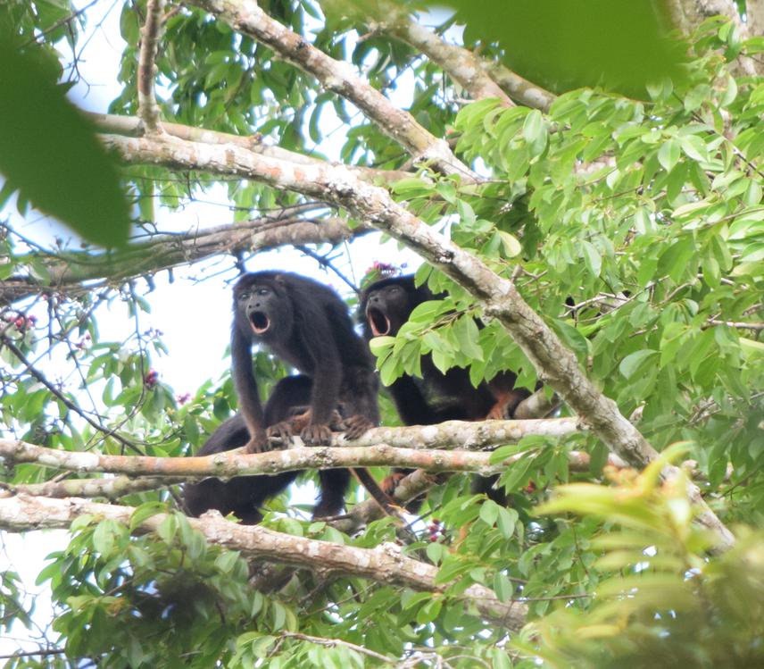
This project will provide the first opportunity to assess the conservation status of the red-handed howler (Alouatta belzebul), a threatened (VU) neotropical primate, on the left margin of the Amazon River. Our proposal comprises three main objectives. We aim to (i) locate populations of A. belzebul and describe its biogeographical limits; (ii) evaluate landscape and ecological characteristics that influence on the occurrence of these primates in forest patches; and (iii) establish a strategy of communication with locals, disseminating knowledge and using participative tools to create a conservation strategy for the species in the state of Amapá.
This project aims to access some important information for the conservation of Alouatta belzebul in the Brazilian state of Amapá. We aim to locate about 50 populations of the species through interviews. We will carry interviews around possible biogeographic barriers to determine extent of occurrence of the species in the state. Interviews will be carried informally. Whenever the interviewee points to the presence of Alouatta belzebul, he will be encouraged to tell more about the biology of the species. The interviewer will also present photographs of mammals known to occur in Amapá, and of some that are known to not occur in the state to access the reliability of the information.
We will access the landscape and vegetation correlates of the presence of this species in forest patches immersed in a savanna landscape. Vegetation will be sampled along 4 meter-wide transects with variable length depending on the size of the patch, where we will evaluate the DBH (Diameter at Breast Height) and the density of trees. The canopy height will be assessed from radar imaging. The remaining variables (understory density and abundance of palm trees) will be accessed every 50 meters throughout the transect. During vegetation sampling, we will stay for a number of days (3-6) within each patch, having an opportunity to confirm the presence of Alouatta belzebul. In those patches where the presence of the species was indicated but not confirmed during vegetation sampling, we will make an additional effort of three days trying to confirm the species presence within the forest patch.
We will also assess landscape attributes, like area, perimeter and shape indexes. In a 1 km buffer around each forest patch, we are going to measure the area of water bodies, natural vegetation (connectivity) and agriculture. Moreover, anthropogenic influences will be estimated by the length of roads and number of houses within the buffer area. At the end of the project, we will carry environmental education activities at schools of communities nearby populations of A. belzebul, when we will try to raise awareness about the species situation, expecting the children to influence their parents. We will also propose conservation actions based on the results obtained in this project.