Julia Caon Araujo
The project will map the coral reefs of the Marine Protected Area Costa dos Corais (MPACC) through remote sensing and ecological data. Through the digital processing of satellite images and field data such as depth points, georeferenced photos and transects we will map the bathymetry and classify the reef environments in relation to geomorphology and benthic habitats.
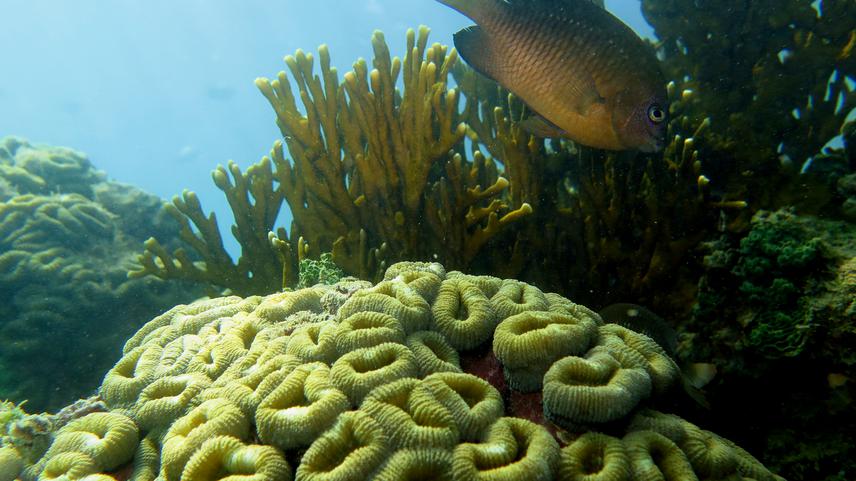
Endemic Brazilian coral, Mussimilia harttii at MPA Costa dos Corais. © Pedro Henrique Cipresso Pereira.
Coastal planning and management are fundamental in marine protected areas and bathymetric mapping is the basis for creating efficient measures in reef areas, it helps to understand the morphological organization of colonies, the zoning of areas of accumulation and removal of sediment, the recognition of pools, normally flat top areas and preferential current paths. In this sense, specific geomorphic features are associated with benthic habitat compartments and can be used to identify important habitats for several marine species. In this way, it will be possible to identify areas of greater ecosystem biodiversity, allowing for more efficient management and protection. In addition, we will be able to quantify specific areas of each habitat and contribute to the monitoring of coral reefs in stressful situations and restoration measures, such as in situations of oil spills and bleaching, facilitating the direction of inspection teams.
The main goal is to transform geospatial information to facilitate decision making to save coral reef areas within the MPACC environment, contributing fundamentally to the territorial management and protection of biodiversity of one of the most sensitive ecosystems on the planet. Knowledge is necessary for protection.
In this way, the information generated from the mapping of shallow and deeper together with field work validation on coral reefs aims to contribute to the planning of emergency actions and mitigation measures in situations of environmental disasters, such as the recent oil spill and massive coral bleaching that occurred in the region.
Locally, the results will be disseminated to the community in environmental education actions in schools and activities of MPA Costa dos Corais. In addition, one of the goals of the project is to make bathymetry, geomorphology and habitat data available in an online geographic information system (GIS) for download, similar to the Allen Coral Atlas, to be used in new research and management actions. The result will contribute to the management and conservation of Brazilian coral reefs and will serve as an example for other regions of the Brazilian coast.