María Eugenia Iezzi
The aim of this project is to analyse the Atlantic Forest connectivity in the productive landscape of the Misiones province, Argentina, to generate forest conservation strategies based on land-use planning.
The specific objectives are:
• Identify a group of species of medium and large-sized mammals that are particularly sensitive to landscape transformation.
• Determine the relative impact of the productive land-uses for each species.
• Identify fragments of native forest that could function as population sources and/or that are a priority for maintaining landscape connectivity.
• Delimit potential corridors for each species in the productive landscape that connect forest patches.
• Corroborate if the corridors are being used by the species doing a field validation.
• Generate recommendations to decision-makers about which areas need to be conserved or restored based on their importance for mammals’ survival and where other threats should be mitigated, and propose
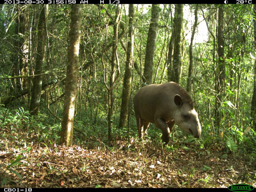
A lowland tapir (Tapirus terrestris) photographed by a camera-trap in the largest forest fragment (potential “source”) of Northern Misiones.
This project aims to improve the Atlantic Forest connectivity for big mammal’s species in the productive landscape of the Misiones province, Argentina. The Atlantic Forest is considered a global hotspot of biodiversity but is an ecoregion that has suffered a long process of fragmentation due to the conversion of native forest to different productive land uses.
Many forest patches remained within the productive landscape that could function as corridors and could promote connectivity between large forest fragments. One of my objectives is to identify what forest remnants have a high contribution to connectivity in order to promote their conservation, and what other ones could act as possible corridors based on their location and/or size but need the implementation of management actions to improve their probability of use by mammals. To achieve this, I will use data already gathered, I will select a group of medium to large-sized mammal species that are particularly sensitive to landscape transformation, and I will do a literature review about the natural history of each species. Using GIS and occupancy models, I will estimate the relative impact of the productive land-uses for each species and identify which fragments function as “sources” and which as “nodes” (e.g., stepping stones that promote connectivity). With this information, I will model and delimit potential corridors in the productive landscape that connect the sources and nodes and identify which forest remnants contribute most to forest connectivity. Using camera-traps, I will corroborate if the corridors are effectively being used by the species doing a field validation.
With the results obtained from my models and after contrasting them with the observed data, I will simulate management scenarios to improve the probability of use of the corridors that had a low frequency of records. Through workshops with policy- and decision-makers, forest company owners and NGOs, I will generate spatially explicit recommendations about which forest remnants are important to conserve or restore. I will also generate recommendations about where other threats should be mitigated (e.g., hunting or road-kills), and propose management actions that could help to improve the corridors´ effectiveness. In this way, this project will promote the connectivity between the large forest fragments that function as species sources and those smaller but important remnants immersed in the productive landscape that are essential for the movement and survivorship of mammal species.