Juan Pablo Seco Pon
The main objective of this project is to identify high risk areas for seabirds, particularly the White-chinned Petrel known to attend fisheries in the Patagonian Shelf.
The at-sea distribution of White-chinned Petrels will be determined by means of remote sensing technology. RSGF funds will allow the deployment of TAV-2617 15g™ - Battery Powered Argos (Telonics Telemetry, USA) in five adult White-chinned Petrel (WCP). Each tag will be programmed to get fixes throughout the day over a four month period. The geographical locations will be obtained by the Argos service (www.argossystem.org).
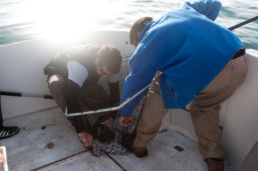
Dr. German Garcia (holding a fish landing net) and Lic. Juan Pablo Seco Pon capturing seabird.
We will use a kernel analysis to determine use areas of 50, 75 and 95% of the total foraging time. Data from the vessels-based surveys, oceanographic variables (e.g. SST, chlorophyll), static variables (e.g. distance to the shelf break, distance to nearest colony), fishery data (e.g. fishing effort) and the at-sea distribution of tracked birds, will be integrated in a Geographical Information System implemented in the package ArcGIS. Oceanographic variables will be obtained from daily satellite images from NASA (http://oceancolor.gsfc.nasa.gov/) with 4 Km spatial resolution; depth will be obtained from National Geophysical Data Center (www.ngdc.noaa.gov/). Spatio-temporal distribution and effort of trawlers and longliners operating in the Patagonian Shelf will be acquired from the National Observers Program reports belonging to the National Institute of Fishery Research and Vessel Monitoring System (VMS, locally MONPESAT) database. Therefore, with the development of this project we will gather accurate and detailed information about the hotspots of White-chinned Petrel throughout their non-breeding season. All information will be included in a Geographical Information System (GIS) in order to produce risk maps and geo-referenced databases.
Further, we will get a better understanding of the interactions between albatrosses and petrels, particularly the White-chinned Petrel, and commercial fisheries over a vast area such as the Patagonian Shelf. All the information will become available to different stakeholders in the country to be used as basement guidelines for the development and improvement of the NOPA-S, already approved by the national government (Federal Fisheries Council Resolution 15/2010, http://www.cfp.gob.ar/resoluciones/res15-2010.pdf). In that respect the information contained in the scientific contributions to be generated will also be converted into technical reports. From our viewpoint the “translation” of scientific data into technical information is essential to provide decision makers with accessible tools that can be ready to use for the developing and planning of conservation measures. As was performed in previous studies, the results will be useful for the development of educational programs and communications to raise awareness in the local community and in the fishing industry.