Ahmed Daoud
Other projects
26 Nov 2015
Assessment of the Status and Distribution of Dugong dugon in Wadi El-Gemal National Park, Southern Red Sea, Egypt
19 Apr 2017
Effect of Tourism Activities on the Behavioural Ecology of Dugong dugon Inhabiting Marsa Alam, Red Sea, Egypt
6 Jun 2023
Assessment the Presence of Dugongs in the Suitable Habitats in the Egyptian Red Sea
Red Sea Dugongs are solitary individuals distributed along the Egyptian Red Sea coast. Dugong feeding trails can be recorded on the seagrass bottom in many sites. Analysis of these trails will be used to estimate the numbers of dugong individuals visited each site in different time. Different in feeding trail width is related to dugong muzzle width as well, it can distinguish between the old and young calves of narrow feeding trial close to that of a larger animal presumably their Mum. The relation between the muzzle width, body length and width of feeding trails will be examined. Information is needed on dugong spatial and temporal patterns, including movement and habitat use. The spatial planning process aims at prioritizing areas for conservation of dugongs while also optimizing the areas prioritized for conservation to reduce conflict with all other users of the seascape.
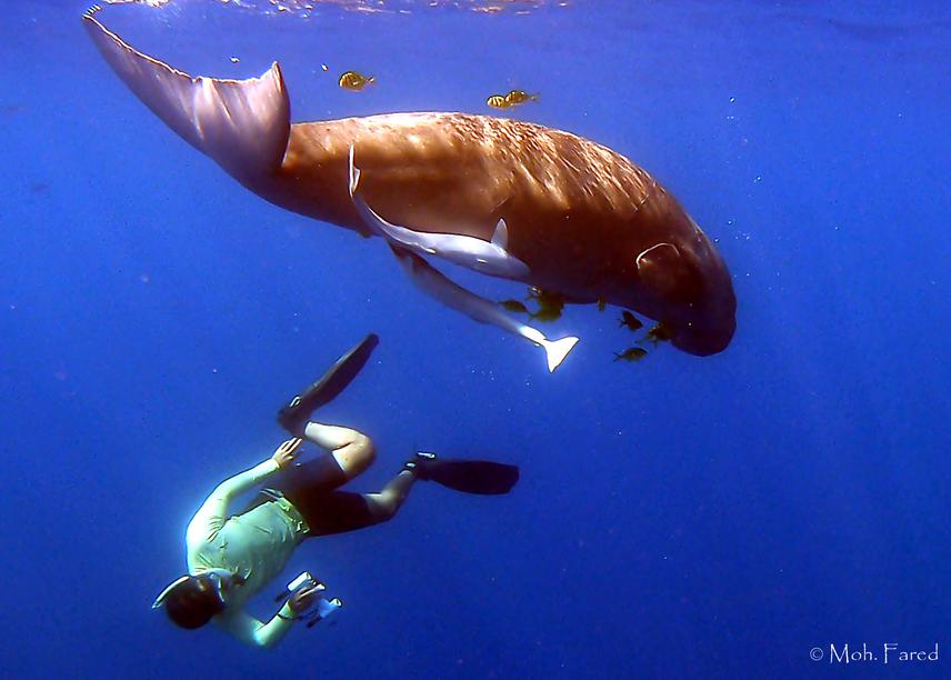
Because dugongs are seagrass specialists, understanding the interaction between dugongs and their seagrass habitats is crucial to their conservation. The habitat of the western coast of the Egyptian Red Sea representing in shallow bays with seagrass meadows is a suitable to the dugong. Red Sea dugongs are scattered distributed and mainly sighted solitary, in pairs and sometimes in a group of three individuals. Dugong encountering underwater is rare and once occurs for short time. The variation in the abundance and densities of dugongs and seagrasses will be studied seasonally.
Total of 30 dugongs were identified using photo identification technique in Marsa Alam and Wadi El Gemal National Park. The re-sighting was recorded for each individual in different sites. Dugong feeding trails are mainly recorded on the seagrass beds that differed in intensity from one site to another. The variation in the width of feeding trails measurements indicated that different individuals visited each site at different times. The data collected by laser photogrammetry is the first time to conduct it on dugong and with continuous using photo identification, it can be used to estimate the growth rate of each individuals.
Different model prediction for dugong habitat, dugong densities and calving will be created in this project. This work uses the available presence-only records to train maximum entropy and Generalized Additive Modelling algorithms to produce layers of predicted suitable habitat, suitable calving habitat and a predicted density surface of the species over the study region in the Egyptian coast of the Red Sea. The predicted information is further used as inputs into a spatial conservation planning process using the simulated annealing algorithm aka MARXAN.
A management plan for DPA (Dugong Protected Area) will be prepared for conservation of different sites located outside the protected area boundaries. I think this project will complete the knowledge and get the whole vision for the dugong conservation by achieving the first management plan for dugongs in the Egyptian Red Sea. Raise awareness of tourists, dive guides, snorkeling guides by conducting the PADI Dugong Conservation Awareness Specialty Course which is a standardized tool for awareness and applying the code of conduct for dugong conservation.