Sanjay Babu
The Shiwalik hills is the western most limit of Asian elephant population, has experienced a huge urban sprawl and land use alteration in last four decades. It has led to degradation of forest and disrupted the movement of elephant. Therefore, the study attempted to assess the Human – Elephant Conflict (HEC) pattern and its mitigation in the Rajaji – Corbett landscape of Shiwalik hills. The study involves the investigation of land use change dynamics between years 1979 to 2015 using satellite imagery, quantifying elephant’ fodder plant species, Spatial distribution pattern using elephant’ occurrence point, and pattern of HEC, in the landscape.
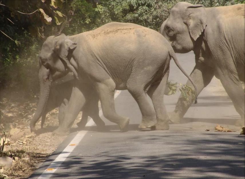
Elephants crossing the road which pass through Ramnagar forest division.
The increasingly fragmented landscape is driving the giant animal into human dominated landscape, giving rise to more human – animal conflict. The Shiwalik Landscape of Uttarakhand, Haryana and south eastern Himachal Pradesh is the north-western limit of wild population of Asian elephant. This forest landscape, like other areas is experiencing demographic changes including enhanced religious activities and urbanization, patterns of forest resource utilization and cropping, certain management actions, increased industrialization and communication network in last few decades have all led to changes in land use and land cover (LULC) and forest cover density. The updated Landscape maps are essential for management planning and strategic decision making for biodiversity conservation. These are also important for mid-course correction and directing future efforts, because ignorance should not lead to irreparable damage. An attempt will be made to analyse changes in LULC in last 35 years using satellite remote sensing data with an objective to find out changes LULC and cropping patterns for cash crops and the man-elephant conflict zones. LANDSAT images of 1979, 1991, 2003 and 2015 will be used to map forest cover type by integrating dry and wet season data to capture phenology using unsupervised classification approach. By categorising all LULC classes into the Forest and the non-forest class, fragmentation analysis would also be carried out.
An extensive field work will be carried out to quantify the different land use habitats and fodder plant species of elephant. Grid based transect survey will be done for detection of elephant. Also circular plots of 10m radius at 1 km distance apart, would be laid along the transect for elephant’s fodder species quantification. In case of elephant sighted, its behaviours will be observed. The validation of accuracy of LULC map will be done using ground truth point collected during field survey. Also, data would be collected about Man-Elephant Conflict from the villages situated within 5- 10 km radius of forest area.
This study will suggest how Land Use Land Cover changes have been taken place between years 1979–2015. HEC zones based on the recorded conflict incidence will also be highlighted. The outcome of the study will therefore help forest department in prioritising the areas where conflict mitigation and conservation measures need to be taken.