Renzo Giudice
This aims to improve the projection and management of the deforestation that will be caused by the paving of the Interoceanica Highway (IOS) in South-eastern Peruvian Amazon.
The Peruvian Government approved in 2004 the construction of the new Interoceanica Highway (IOS), an official road seeking to boost the national road infrastructure, aiming for the interconnection and socioeconomic development of the Southern Region of the country. The IOS extends Brazil’s TransAmazon (BR-230) highway through southern Peru and will link Brazil to Peruvian ports on the Pacific, and connect hundreds of towns, villages, and agriculture, ranching and other economic activities to national and international markets.
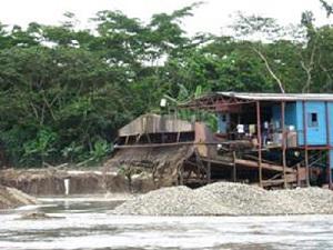
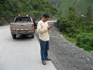
However, the IOS passes through one of the world’s largest, most intact, and highest-biodiversity tropical forest regions, and within 10 km of the Bahuaja Sonene National Park. The IOS will inevitably cause habitat fragmentation, conversion, degradation, carbon release, and the reduction of animal populations. Simply the prospect of the IOS has doubled the rate of forest clearance along its Peruvian section in the province of Madre de Dios, compared to a few years back.
With this project, we will contribute to the understanding of the spatial scale, distribution, and tempo of deforestation, and how different conservation interventions might act to reduce this process. Therefore, the main aim of the project is to provide a visualization and forecasting tool to guide conservation efforts. Such a tool will allow conservation organizations to set down clear predictions about the effectiveness of their conservation interventions, and thus, to receive regular feedback about their performance in an ever-changing environment. Moreover, the project will help avoid overlapping conservation efforts, thus saving money and time, since initiatives will be mapped. Finally, a simulation system such as this will also provide conservation organizations with a tool to communicate the dynamics of deforestation to non-experts, including the local and national populations and governments.
The project will use the software package DINAMICA, a stochastic cellular automata model, which has been used to simulate deforestation in the Amazon Basin. DINAMICA will be used to determine the probabilities of deforestation, based on previously observed patterns and the spatial arrangement of physical and land-use variables. These trends will be later modified according to observed land-use changes and socioeconomic variables. Finally DINAMICA will be used to model different governance scenarios (such as private protected areas) and predict their effect on the deforestation process.