Placide Masengesho
Other projects
17 Jun 2022
Effect of the Road to the Population of L’hoest’s Monkeys (Allochrocebus lhoesti) in Nyungwe National Park, Rwanda
This study investigates the temporal dynamics of faunal communities and vegetation structure in Rugezi Marsh, Rwanda’s only Ramsar-designated wetland, through the integration of environmental DNA (eDNA), sedimentary ancient DNA (sedaDNA), and remote sensing tools. The research seeks to understand how historical and contemporary shifts in biodiversity are linked to long-term changes in vegetation structure and land-use/land-cover (LULC) patterns. The importance of Rugezi Marsh lies in its rich ecological, hydrological, and socio-economic values. It serves as a biodiversity hotspot, a crucial habitat for papyrus-dependent and endemic species such as the Grey Crowned Crane (Balearica regulorum), and a vital water source feeding Lakes Burera and Ruhondo, which power national hydropower stations.
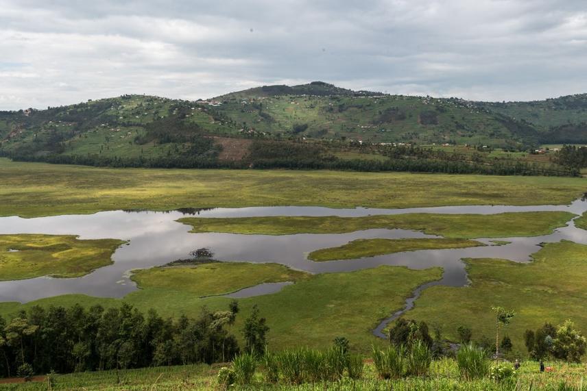
Rugezi marsh © Placide Masengesho
Three core objectives guide the study: (1) to assess temporal patterns in faunal community composition using both contemporary eDNA metabarcoding and historical sedaDNA analysis from sediment cores; (2) to quantify long-term vegetation and LULC changes using drone imagery and satellite remote sensing; and (3) to explore the relationship between biodiversity trends and habitat transformation across time. The research design involves stratified sampling of vegetation types (e.g., Miscanthus sp., papyrus stands, peat-floating complexes, open water channels) and sediment coring using a long peat corer to reach deeper historical layers. eDNA and sedaDNA samples will be extracted and sequenced to detect species presence across temporal strata.
Vegetation structure will be mapped using NDVI, supervised classification, and orthomosaics from drone surveys, supplemented with Landsat and Sentinel-2 imagery for historical trend analysis. The integration of these datasets will allow for spatiotemporal comparisons of biodiversity and habitat change, offering insights into wetland degradation, conservation effectiveness, and ecosystem resilience under environmental pressures. The anticipated findings will provide baseline data for long-term biodiversity monitoring and inform adaptive conservation strategies for wetlands in Rwanda and similar ecosystems globally.