Olga Alejandra Vargas Fonseca
Other projects
2 Dec 2013
Role of Marine Protected Areas in the Population Dynamics of Indo-Pacific Bottlenose Dolphins (Tursiops aduncus) along the Southeast Coast of South Africa
17 May 2024
Traditional Ecological Knowledge of Dolphins in South Africa: A Case Study of an Integrated Approach for Conservation of the Indian Ocean Humpback Dolphin
Provide a baseline estimates of abundance of inshore dolphins, identifying priority areas for protection and assessing effectiveness of current MPAs.
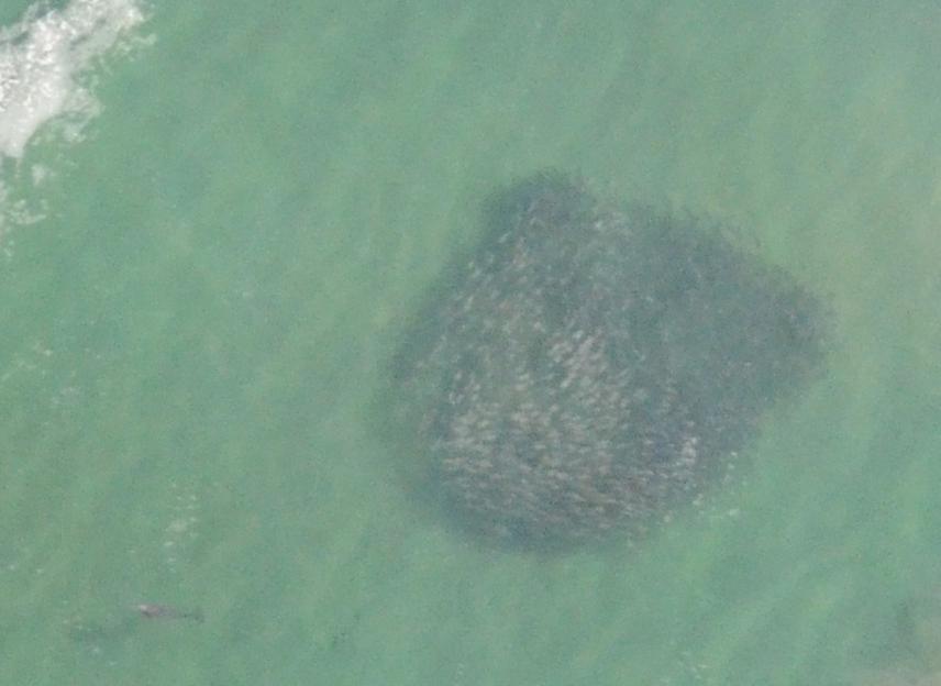
Bait balls along Garden Route.
Indo-Pacific bottlenose (Tursiops aduncus) and humpback dolphins (Sousa plumbea) are under the IUCN Red List as Data Deficient and Vulnerable species. They largely utilise inshore waters and are susceptible to anthropogenic pressures such as coastal development, pollution, tourism and effects of fishing. However, their movement patterns and habitat use including “hotspots” of activity (e.g. for feeding) along South Africa’s coast remain poorly understood, hampering the design of effective spatial conservation measures.
Boat-based surveys are being conducted along a 140 km stretch of coastline which includes three MPAs (Goukamma, Robberg and Tsitsikamma) to determine abundance, distribution and habitat use of the dolphins and how these relate to the existing MPA boundaries. Boat-based surveys are costly, time-consuming, highly weather-dependent and cetaceans can only be reliably detected within a relatively narrow transect width and ideally therefore need to be supplemented with an alternative method. Aerial surveying has been selected because it is relatively economical in terms of time and cost and provides greater detectability over a wider area.
This would be the first known comprehensive study comparing abundance estimates using two different methodologies: boat-based surveys utilising photo identification and mark-recapture techniques and aerial surveys using the distance sampling technique. The abundance estimates of the two species obtained along the coastline at different times of the year through aerial surveys will be contrasted with boat survey estimates conducted over the same period. The aerial survey approach is considered to be most useful for longer term monitoring because it its relatively economical, effective and replicable, therefor the study also provides a comprehensive baseline for future comparison and trend evaluation. Hotspots of dolphin activity will be identified based on spatial preferences and behavioural types determined from the surveys, with relevance for spatial conservation management.
Aerial surveys will also provide baselines of abundance and seasonality for other megafauna species such as humpback whales (Megaptera novaeangliae), southern right whales (Eubalaena australis) and Bryde’s whales (Balaenoptera brydei), long beaked common dolphins (Delphinus capensis), great white sharks (Carcharodon carcharias), hammerhead sharks and other elasmobranchs in the area. The recent increase in sightings of great white sharks by the public has sparked concern and aerial surveys will assist in determining if these sharks exhibit seasonality and provide a baseline for ongoing monitoring.
The project makes an important contribution to assessing the temporal and spatial effectiveness of the current MPA network in supporting the two dolphin species and other marine top predators.