Kanchan Parajuli
Parsa Wildlife Reserve is the largest wildlife reserve in Nepal and is a home for many globally threatened species; however, associated human-wildlife conflicts are not well documented. This study aims to understand the spatio-temporal pattern in human-wildlife conflicts through direct field evidences and semi-structured questionnaires with local people, community forest user groups, and government officials. Workshop on human wildlife conflicts will be organized to discuss and to find remedial measures for conflicts. Community awareness program will be carried out to reduce the conflicts and encourage species conservation. The project should help government to developing plans and policies for mitigating human-wildlife conflicts.
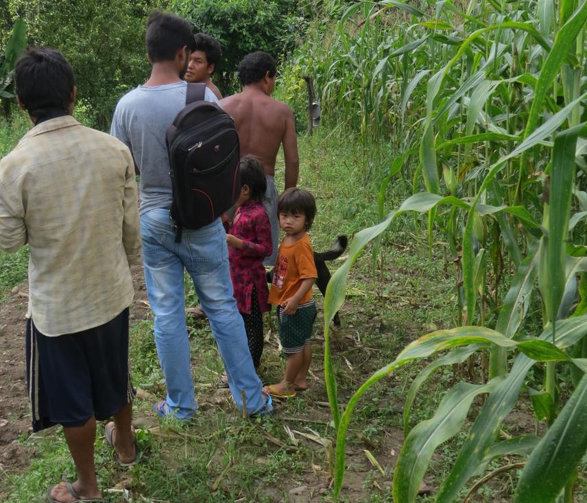
Observing the maize farmland damaged by Wild Bore.
The largest wildlife reserve of Nepal, the Parsa Wildlife Reserve (PWR) (Gazetted 1984, Area-499 sq.km + buffer zone 298.2 km2), lies in the inner terai lowlands of central Nepal. Conflicts and poaching associated with globally threatened mega fauna like Bengal Tiger, Asian Elephant, Great One-horned Rhinoceros, Common Leopard, followed by Wild Boar, Chital and Antelope species etc. are commonly witnessed and read in the daily newspapers and on television. This is because many people live in buffer zone and outside the buffer zone of PWR and depend on farming and livestock rearing. Animals from PWR usually depredated a lot of their crops (rice, mustard, lentils, maize, wheat, etc.); in response retaliatory killing commonly takes place in the periphery of PWR. The East-West highway and Hetauda-Birjung highway pass through the core of reserve which increased the frequency of road kill of most species. There is no data available about such road kills of animals in this area. The major reasons for increasing human-wildlife conflicts are the lack of awareness and communication gaps between PWR and local people. Therefore it is necessary to document all associated human- wildlife conflicts to evaluate the economic loss and find ways to conserve the threatened animals.
This project aims to understand the extent of human-wildlife conflicts in PWR and its adjoining areas. The pattern of crops and livestock depredation by threatened megafauna and other species will be identified from this research. Economic loss raised by the human- wildlife conflicts will be analyzed. The frequency of road killed animals and their spatial-temporal variation will be known – currently these issues are underestimated from the area. After analysing the cause, pattern and economic loss of the human-wildlife conflicts, the project will gather information about the conflicts in and around PWR through a workshop. The project will gather students, researchers, community forest user groups, government officers (District Forest Office, PWR, buffer zone Committees, Department of National Parks and Wildlife Reserve) and medias (print and online) in one table by organising a workshop at PWR to discuss, document all conflicts scenario and propose possible mitigating measures. The most conflicting areas, the hotshots and pattern of the human-wildlife conflicts hotspots will be identified. The project aims to increase the level of understanding of the people towards the importance of wildlife in the ecosystem and their livelihood by conducting a community and school awareness program. Likewise, school children should become aware about the importance of globally threatened species and help to spread the positive message in their villages for the species conservation. Finally, outcomes of the project should provide baseline information for the government and PWR for preparing management plans and policies and their implementation to reduce human-wildlife conflicts.