John Paul Payopay
This project addresses the urgent decline of mangrove forests in Pangasinan where these critical coastal ecosystems face severe threats from aquaculture expansion, urbanization, and climate change. Despite being home to 25 of the Philippines' 39 true mangrove species, the province lacks comprehensive scientific data to guide effective conservation and restoration efforts. The research aims to fill this gap by creating detailed maps that identify where mangroves should be protected and where degraded areas offer the best opportunities for restoration.
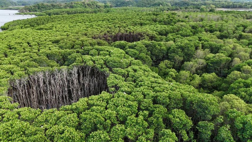
Dieback of mangroves from hydrological and environmental stress at Alaminos City, Pangasinan, Philippines. © 2026 John Paul Payopay. This image is original and owned by the author. All rights reserved.
The project employs high-resolution aerial imagery of mangrove areas across the province's coastal municipalities. These images are processed to create accurate maps of current mangrove coverage, which then inform models that predict where different mangrove species can thrive based on environmental conditions like climate, soil, and coastal geography. A key innovation of this work is combining multiple mapping approaches to identify restoration priorities. By analysing current land use patterns alongside habitat suitability predictions, the project pinpoints degraded coastal areas that have high potential for successful mangrove restoration. The research also assesses connectivity between existing mangrove patches to identify critical corridors that maintain ecosystem health and resilience.
Local communities and coastal fishing families are central to the project's success and sustainability. The research team conducts workshops and training sessions, including local government units, community representatives, and academics. These sessions present findings through accessible maps and visual tools, ensuring that technical results translate into practical conservation actions. Community members participate directly in field validation activities and restoration planning, fostering local ownership of conservation outcomes. All maps and decision-support tools are shared with local government units at municipal, provincial, and regional levels in formats they can readily use for coastal management planning.
Beyond immediate conservation gains, the project aims to build lasting capacity among local stakeholders by training them in monitoring techniques and basic mapping applications. The findings are incorporated into official coastal management plans and climate adaptation strategies, ensuring the research continues to guide conservation decisions long after the project concludes. By combining rigorous scientific modelling with meaningful community engagement, this work seeks to protect Pangasinan's remaining mangrove biodiversity while restoring degraded habitats that provide essential services including coastal protection, carbon storage, and fisheries support for local livelihoods.