Harris Wei-Khang Heng
Other projects
23 May 2017
Mapping Dugong Habitat and Understanding Dugong Feeding Preferences in Sibu-Tinggi Archipelago, Johor, Malaysia - Towards Critical Habitat Protection
Long-term data on the estimation of endangered dugong populations in Malaysia is scarce due to relatively challenging and high cost to conduct the conventional manned aerial survey. The Sibu-Tinggi Archipelago in Johor, Malaysia, appears to host a significant population of dugongs, owing to the presence of extensive seagrass meadows. However, there remains a lack of information on its population abundance in the area, which in turn limits our full understanding of how the population will be affected by various natural and anthropogenic disturbances. This project aims to transform the conventional field method into using unmanned aerial vehicle (drone) which is a more accessible and relatively cheaper technology, to become a scientific tool in documenting the population size and spatial information of dugongs. By gathering baseline data on dugong populations and spatiotemporal habitat utilisation patterns, greater conservation efforts can be focused on the protection of dugongs.
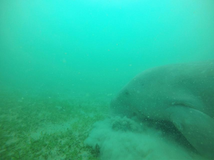
A dugong feeding on the seagrass in Sibu Island © UMSD Team.
We have conducted field surveys from 2016 to 2018 to collect spatio-temporal data on the foraging activities of the endangered dugongs (Dugong dugon) in the Sibu-Tinggi Archipelago. Throughout this sampling period, we have observed that dugong sightings have become increasingly rare and seagrass habitats reducing in extent an abundance. With so little known of this elusive marine mammal, particularly their population size, movement, habitat use and habitat extent, there is hence an urgent need to fill up these knowledge gaps, in which data collection is impeded due mainly to the existing costly field survey methods.
This study aims to fill up the knowledge gaps by experimenting the potential of transforming data acquisition through traditional aerial survey, i.e. occupied aircraft, into using unmanned aerial vehicle (drone) to facilitate long-term monitoring and conservation efforts especially in a developing country, in which field surveys are often impeded by high cost, time and risk exposures. This project, thus, aims to determine the dugong population estimates and their use of the seagrass habitats in the Sibu-Tinggi Archipelago. It is expected that the study will (1) determine the density and distribution of dugongs in their habitats, (2) identify the visual hotspot areas, and (3) elucidate the main overlapping areas between the visual hotspots, core foraging grounds and human activities.
Through our previous study on dugong spatial foraging ecology, we were able to identify their core foraging grounds in addition to the areal size and distribution of seagrass habitats. Thus, we will be using this information to conduct mid-range systematic aerial drone surveys to obtain a population estimate and movement behaviours data of the dugongs, covering areas within and outside of their core foraging grounds. In the Sibu-Tinggi Archipelago, dugong populations are still threatened by human activities such as entanglement in gill nets. As such, we will also investigate whether human activities are prevalent in dugong hotspot areas.
Long-term wise, we will test the optimal drone operating procedures aimed to provide a more accessible gateway in developing a spatiotemporal database of dugong population size and habitat utilisation patterns, which in turn will contribute to more effective conservation planning.