Subham Banerjee
The eastern Terai in India is the habitat for several endangered and endemic species. Here we propose to study the vegetation of Manas National Park, a typical grassland-woodland mosaic of the Terai that shows high spatial complexity and temporal dynamism. We will collect extensive ground data on vegetation structure and plant diversity and couple it with remotely sensed data. The result would be vegetation structure and species diversity maps for the entire landscape. Using these maps, we will make critical habitat assessments for five endangered species, the Indian Rhinoceros, Swamp Deer, Pygmy Hog, Hispid Hare, and the Bengal Florican.
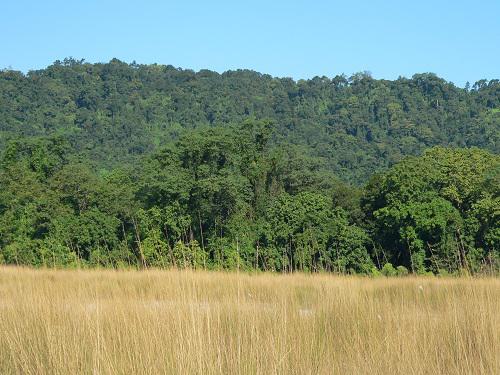
General Landscape of MNP
Manas National Park (MNP) is situated in the North-Eastern part of India, in the state of Assam (latitude 26°35’ N - 26°50’ N, and longitude 90°45’E - 91°15’E), along with the Northern belt of Brahmaputra Valley and the Indo-Bhutan international boundary. MNP is rich in biodiversity. The impressive list includes 21 endangered species (IUCN Red list).
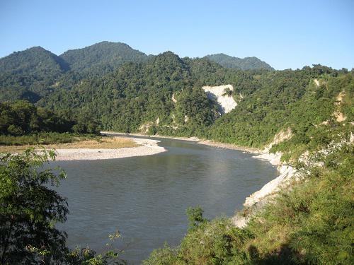
River landscape of MNP.
The key goal of this project is to map the vegetation and wildlife habitat at high spatial resolution for a species-rich landscape of over 500 Km2 in an area that has high spatial heterogeneity. This is possible only with a combined dataset of extensive ground or field measurements and remotely sensed data. I will first identify major vegetation formations using the field data from 130 rapid assessment plots (preliminary data from an ongoing study) and Landsat TM/ETM+ data. After identifying the vegetation formations, I will locate about 10 plots in each of 5 or 6 major vegetation formations that are likely to be identified. Each plot will be 30m X 30m in size. For both monocot and dicot plants, I’ll identify all of them either in the field or by herbarium preparation. After identification, I’ll analyse soil samples for physical and chemical properties, including N, P, base cations, and several micronutrients for at least 50 samples (from the newly established plots). Then, I will use plant diversity and plant community structure data from my 180 vegetation plots to create a comprehensive plant community database for the MNP landscape. Next, I will process the appropriate Landsat TM/ETM+ 30m resolution multispectral data to derive the Normalized Difference Vegetation Index (NDVI) values for the MNP landscape. I will then test for a significant relationship between Landsat NDVI and plant community structure. I will also test for relationships between plant community structure and climatic parameters such as rainfall and temperature using Bioclim data obtained at 1 Km2 resolution.
The final goal of the project will be assessing habitats for important bird and mammal species that are the focus of wildlife conservation. In addition to providing useful insight on the overall habitat characteristics of MNP that should help in habitat conservation and management. My study will generate knowledge and data that area managers can directly use for conservation and address critical habitat requirements for Indian Rhinoceros (Rhinoceros unicornis), Swamp Deer (Rucervus duvaucelii), Pygmy Hog (Porcula salvania), Hispid Hare (Caprolagus hispidus) and Bengal Florican (Houbaropsis bengalensis).