Armindo Da Silva
Other projects
20 Dec 2007
Elephants (Loxodonta africana) Conservation Planning and Monitoring in Mozambique Central Ecosystem Using GIS and Remote Sensing
The aim of the project is to improve long-term elephant conservation by creating an integrated (includes all system components) geodatabase rainfall variability.
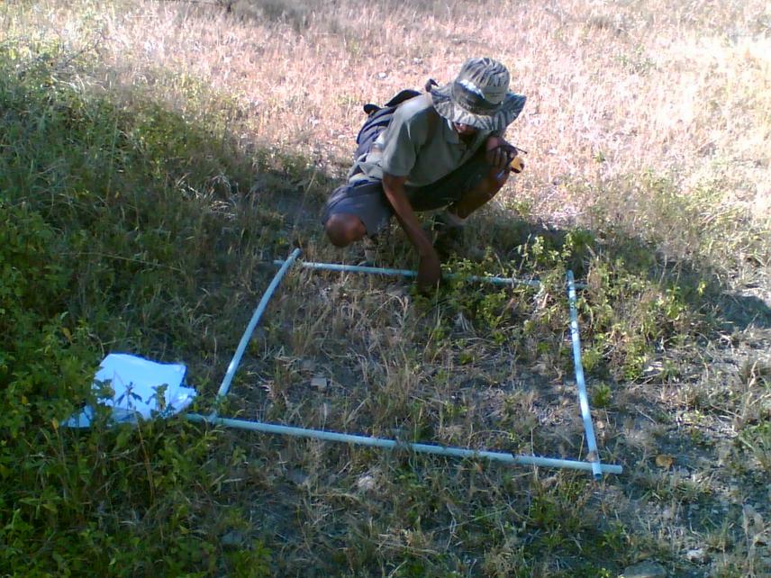
A quadrat is used to sample the species present in a habitat.
Loss of habitat is the largest threat facing wildlife in Africa in particular for large mammals (Allen and Starr 1982; Wiens 1989; Noss 1990; Spellerberg 1991; Stuart and Stuart 1994). The reduction of large habitats to smaller and isolated remnants cut-off migration corridors and affects their abundance and distribution (Wilcove et. al.1986; Craston 2006; Wilson et.al. 2006). As a result, in semi-arid rangelands of Mozambique Central Ecosystem-SARMOCE, when wild fauna moves beyond their sanctuaries in search of food they inevitably run into trouble, often from farmers sleeping on their fields trying to protect crops. Because farmers do not want to lose their crops, they kill elephant particularly during severe drought. Three thousand elephant existed prior 1983 drought and only 108 elephants were recorded in 1994 (Hatton 2001). Elephants of SARMOCE were more likely dictated by water availability, land uses and vegetation diversity (Da Silva and Nombora 2010), which in turn are determined by rainfall variability.
However, we want to improve long-term elephant conservation by creating an integrated geodatabase rainfall variability model. We assume that elephant conservation activity will often affect other components of the system. For that reason, we first inspect rainfall variability and its relationship with soil water availability. Second, we assess the other components of semi-arid rangelands such as animal populations, vegetation, indigenous people customs, land uses and livelihoods. Third we explore the interrelationship (linear and nonlinear) between rainfall (soil water availability)-livelihoods-land uses and animal population (elephant). The assumption behind this activity is: rainfall mostly influences soil water availability which in turn dictates land use and land-based livelihoods distribution that affect loss of habitat and consequently the distribution of elephant, their numbers and poaching intensities.
This work will aid to explain to which ecological threshold elephant forage varies in response to rainfall variability and how wildlife should sustainably adapt to it.
Further, it will raise community awareness on innovative rangeland management tools in order to wisely they know how can enhance their land uses and livelihoods in order to meet local climate variations and elephant ecological requirements in different spatial and temporal scales. In addition, an integrated geodatabase is a tool for data sharing and integrated planning. Effective planning brings good management, which in turn produces positive changes. Integrated planning also contributes to reducing conflicts in land uses and to meeting the needs of Mozambican growing population (1.7% in 1997 to 2.6% in 2007, see INE 2007).