Mao Amis
This project seeks to develop tools and methodologies for identifying threatened freshwater ecosystems, develop an approach for the integration of freshwater and terrestrial perspectives in conservation planning, and assess the impact of the divergent water management policies on freshwater ecosystems in South Africa.
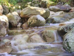
An upper foothill river.
The Cape Floristic Region (CFR) of South Africa is a region of global significance as a biodiversity hotspot. The CFR is home to the greatest concentration of non-tropical plants in the world, but it's also severely impacted by water stress. Freshwater ecosystems in general face severe threats from anthropogenic disturbances.
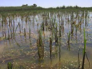
Different wetland types found in the study area.
Assessing threats to these systems has been complicated by the lack of rapid assessment techniques, thus hampering efforts to prioritize them for conservation intervention. Often very little is known about some of these systems, which may otherwise possess a high level of biodiversity and the provision of ecosystem services. Land use and climate change are some of the major threats to freshwater ecosystems, and unlike in the terrestrial ecosystems where species distribution is expected to shift in response to global warming, when the water warms up, freshwater biota have no where to escape. However, currently concerns for climate change have not been integrated into protocols for reserve selection. Freshwater biodiversity have been overlooked in most terrestrial conservation planning exercises because of the complexity of integrating these systems.
This project seeks to develop tools and methodologies for identifying threatened freshwater ecosystems, develop an approach for the integration of freshwater and terrestrial perspectives in conservation planning, and assess the impact of the divergent water management policies on freshwater ecosystems in South Africa.
Spatially explicit data on freshwater systems for GIS analyses will be gathered and available datasets verified through extensive field surveys, to ascertain whether major sources of pollution and other anthropogenic disturbances have been accurately captured. Statistical and GIS-based modelling will be used to identify threatened freshwater watersheds under land use change and other anthropogenic disturbances, and for developing approaches for integrating freshwater ecosystems into terrestrial priority areas. An extensive literature review, expert workshop, and short interviews will be undertaken with various stakeholders to evaluate the extent to which policies implemented at the watershed level are reminiscent of the national and regional policy context.
Expected output include an approach for identifying vulnerable freshwater systems, a comprehensive database on freshwater ecosystems, maps and booklets for land use planners and the general public, capacity building in freshwater conservation.