Ariany Garcia
This project aims to determine the dynamic of use that have the cave-dwelling bats in the shelters (caves) located in arid and semiarid zones in northern Venezuela.
Despite of being the habitat of a unique flora and fauna, many dry Neotropical ecosystems are threatened as result of strong land cover change. Bats are vital in these ecosystems as pollinators, seeds dispersers and predators of many species of insects; however, these mammals are very susceptible to human and natural disturbances, specially through modification and destruction of their habitats and diurnal roosts.
In northern South America, cave-dwelling bats associated with dry ecosystems are particularly vulnerable, because large caves are scarce in arid zones, and therefore they shelter thousands of bats. Any disturbance occurring in a cave will affect all bats inhabiting it. The deleterious impact of disturbances becomes critical during the reproductive period, when newborns are present in the roosts. Arid and semiarid lands in northern Venezuela are exposed to intense anthropogenic pressure and most caves present in these lands are out of protected areas. In order to design effective conservation programs to preserve the bat fauna associated with these areas, the first step had been identify and georeferenced some bat-caves, and with monitoring each two months for one year, we will be able to describe their biophysical characteristics, determine bat-species composition, and understand how bats use caves over the year.
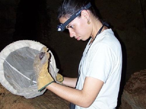
The monitoring will consist in: capture of bats with mist net or harp trap, identify the species, take body measures and identify sex, reproductive conditions and age; use direct or indirect methods to estimated the number of individuals inside the caves; register climatic parameters inside and outside the shelters (temperature and humidity), and described de physical structure of caves (dimensions, number of chambers) and relative locations of bats species inside them. Geographical location of caves and all this information will be represented on a Geographical Information System.
Altogether, this information will allow us to determine the most vulnerable species of bats and critical times for each cave throughout the year. We will use these data to design conservation calendars customized for each cave. The GIS and the information of this project can be used as a baseline for any governmental or nongovernmental initiative aimed to guarantee the preservation of the bat fauna in arid zones.