Prashant M. Hedao
Integrated conservation planning involves data analysis of physical, human and political geography of the region and incorporates traditional knowledge of local stakeholders. This research will study the central region of Kodagu district as a case study which is a mosaic of forest patches interspersed with large coffee estates, small farms and is frequented by elephants from surrounding forests that results in human-elephant conflict. A landscape approach will be used for conservation planning using Geospatial technologies and Geodesign to integrate all information.
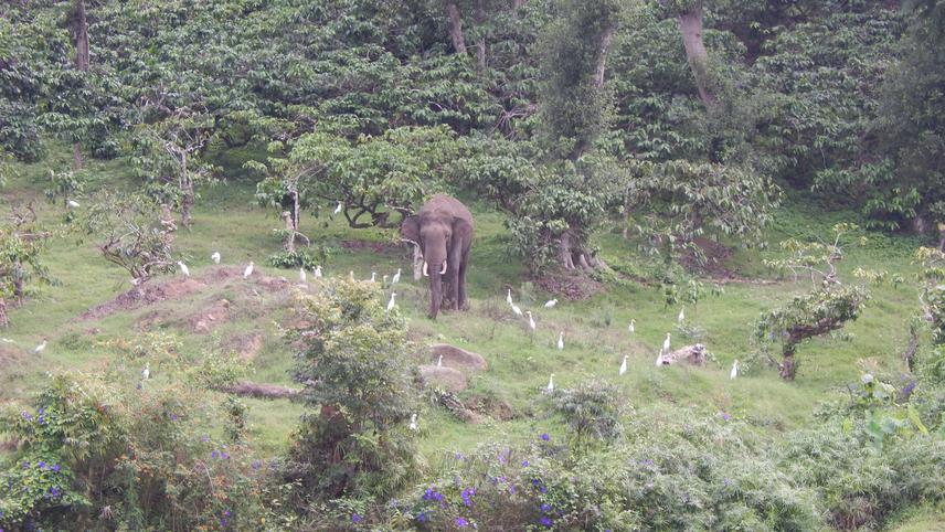
Elephant in Coffee Estate.
Today wildlife is not confined exclusively to protected areas and sizable numbers exist outside reserves which, among other things has resulted in increased human-wildlife conflict. The future of conservation will depend on how best we plan areas where humans and wildlife can co-exist, such as landscapes adjoining protected areas. Geodesign is a new, emerging field that involves bringing in spatial information for various geographies into a Geographic Information System (GIS) for design. Conservation planners take GIS based analysis and use it for design and planning. Data is drawn from several sources, such as government databases, satellite imagery and data from field surveys. Another important source is “traditional knowledge” that resides with local communities and other local stakeholders that comes from their long relationship with the landscape where they may have lived for several generations.
This valuable information, obtained only from them makes them and their knowledge an important component in the planning process. This has been experimented with by using GIS based landscape analysis tools in other parts of the world, e.g. California and Kenya, where it was used to incorporate community’s aspirations by mapping them to create projected scenarios for the region. This research project will look into how best these landscape analysis tools can be applied in Kodagu district that has a human dominated agrarian landscape, is surrounded by protected areas and reserved forests on three sides that supports a sizable elephant population. It will also research into ways of incorporating traditional knowledge of stakeholders into GIS and how best to use this in Geodesign for integrated conservation planning. The methodology refined under this project using Geodesign and stakeholder participation will undoubtedly find application for conservation planning in other landscapes in different geographic regions. This project could therefore play a significant role in the future of conservation.