Cesar Rojano
The aim of this project is to identify the effect of roads on the behaviour and home range of giant anteaters, and understand how this species uses landscapes fragmented by roads and their associated crossing structures (e.g. bridges, box coulverts). For this, a GPS collar will be installed in two individuals in an area near the "Marginal de la selva" road for 6 months each one. The data generated will allow us to make analysis of the landscape, identifying critical points in which measures will be proposed to manage this threat and to propose mitigation measures to the builders who will be working during the next three years in the extension and construction of 380 km road between Yopal and Villavicencio.
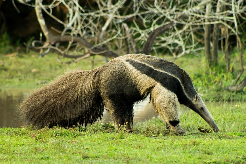
The giant anteater is listed as Vulnerable throughout its distribution range, including Colombia. Roadkill mortality has been described as the main threat to this species in some regions of Latin-American, including Colombia. In our country, this has been reported as a threat in large parts of its distribution. In two years we have registered approximately 150 anteater’s road killed, with a frequency of 0.3 ind/day only on 80 kilometres section of the “Marginal de la selva” road. Taking this into account we have identified some hot spots with the highest rate of anteater’s roadkills, where we have establish some traffic signals. In the same way, we have developed an education work with the drivers of the way. However, the measures taken to date have not been fully effective. Therefore, it is necessary to generate research to understand ecological aspects of the species, associated with habitat use and the use of existing road structures (e. g., underpasses, box coulverts, and bridges) as steps.
Taking this into account, this project proposes to contribute to the understanding of this problem using the following methodology: we will be working with the local community in the study area to define conditions necessary for the development of the project, including security, commitment to care of the animals and help with the monitoring of the specimen. Two individuals will be captured through the use of line transects and the active search method. When located, individual will be lassoed, and anesthetized each captured giant anteater will be monitored using a harness with a GPS + VHF + Iridium Satellite Communication + Wireless communication radio transmitter. The collar will send 24 location data to fieldworker by email every day. This will provide an update of the animal status. After 6 months the animal will be captured with the same methodologies and the harness will be retired. The individuals will be released at the same place of capture. The emailed location data will be used to produce a distribution maps for the radio marked giant anteaters. This maps will allow us to characterise the habitat in the zone, including the related road section and their associated crossing structures. Home range, and habitat use maps will be constructed, patterns of behaviour and use of the road will be established. Likewise, a spatial analysis will be carried out based on satellite photos.