Yelena Gambarova
Other projects
30 Apr 2013
Rare Plant Conservation in Azerbaijan: Monitoring Threats and Education of Local Community
7 Dec 2015
Increasing Capacity for Biodiversity Conservation: Long-Term Integrated Research and Conservation Education Program, Azerbaijan
12 Mar 2018
Evaluating the Effectiveness of Long-Term Integrated Research and Conservation Education Program, Azerbaijan
This Project aims to identify and describe the extent of rare vegetation communities found within the various habitats in the south of the Azerbaijan Republic.
/906e709eba1756f82398e596c0c0b2b8.jpg)
The Study Area at Gobustan contains a wealth of historical and archaeological sites and is also known for its rare vegetation. The desert communities in the Gobustan State National Park represent the most ecologically important habitat, from a botanic point of view. Some of vegetation within this study area now being classified as either rare or threatened and recommended for inclusion in an updated National Red List and some species are listed as globally threatened. The great age of many of the desert communities and their slow growth rate further enhance their botanic significance.
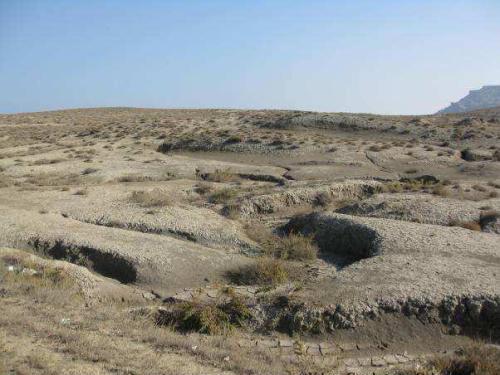
These are the most natural and extensive habitats of the region and have a national significance due to this area being a stronghold for mugwort species (Artemisia fragrance) and several species of saltwort (Salsola species). There are also arable communities, which contain semi-desert elements such as camel prickle (Alhagi pseudoalhagi) and sea blight (Suaeda dendroides). The importance of this habitat type is one of the reasons that the Gobustan desert has been proposed as a State National Park, so that some level of protection is offered to this desert.
The methodological approach of this Project includes theoretical and practical training on field identification and census methods and the use of standardized monitoring methods. Remote sensing and monitoring using satellite images can provide important information for rare vegetation distribution. A number of steps were involved in the process of the project, including Geographical Data Base design, Creation of Specialized GIS Environment and classification. Finally, a comparative method using Normalized Difference Vegetation Index (NDVI) was applied for determination of Rare Vegetation change over time. NDVI change was taken an account on the changes which happen on rare vegetation distribution in the Study Area from 2004 to 2007.
During the project and after its completion the members of the project team will organize several lections and slide shows in a local schools and organizations. At these meetings representatives of the team will be providing schoolchildren that information about the project. After the completion of the project few articles, describing the main point of work done by our team, will be published in local and international scientific journals.