Abiud Kaswamila
The aim of this project is to test on the ground the newly developed Buffer Zone Land Use Planning (BUZLUP) Framework so that lessons learnt can be extrapolated to other parts of the world with similar socio-economic and environmental setting.
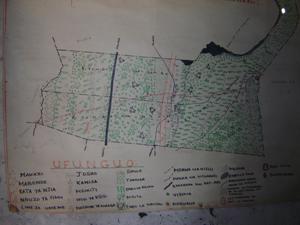
The Burunge Wildlife Corridor in the Maasai steppe (northern Tanzania) encompassing three villages, via: Kwakuchinja, Sangaiwe and Minjingu is an important wildlife migratory route and dispersal areas for Tarangire, Lake Manyara and Serengeti National Parks. Despite its importance, the corridor is increasingly threatened by anthropogenic factors which have led to both encroachment and human-wildlife conflicts. In order to achieve conservation and development, the project intends to prepare and implement the Buffer Zone Land Use Planning (BUZLUP). The BUZLUP framework is a new approach developed in Tanzania for use in areas where humans co-exist with wildlife.
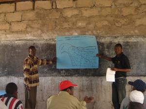
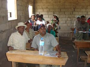
The project’s main objectives are twofold. First, is to create awareness education among local communities living adjacent to Tarangire National Park on the importance of land use plans in conservation and poverty reduction. Second, is to use the prepared and implanted land use plans to mitigate human-wildlife conflicts (HWC) between conservationists and local communities living adjacent to Tarangire National Park. These two objectives will be achieved through a series of activities which will involve different stakeholders at District and local level. At District level, consultation with District Natural Resources Board to discuss the project before the take of the project. At village level several activities will be carried out: stakeholder analysis, awareness education among local communities on the importance of land-use plans, and stakeholder training on participatory rural appraisal skills. This will then be followed by the preparation of participatory land use plans in three study sites as described in the BUZLUP Framework. After having plans on the ground, mobilization of all resources necessary for the plan implementation with assistance from local leaders, team leader and district planning team. To ensure effective implementation of the plans, frequent plan monitoring (quarterly) will be effected. This will be carried out by the team leader in collaboration with village leaders. On the other hand, project evaluation will be initiated three years after the take-off.