Lydia Natalie Tiller
This project will determine human-elephant conflict patterns and quantify land-use change, thus finding the best ways to mitigate and manage conflict, whilst securing elephant habitat.
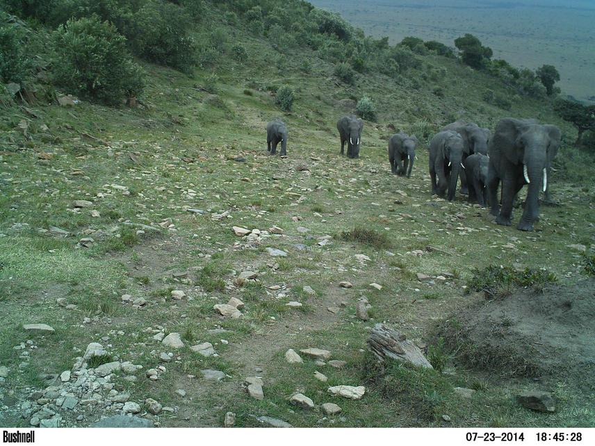
An elephant pathway in the Transmara that leads to many farms.
Elephant numbers in Kenya have decreased from 167,000 in 1973 to just 35,000 today. This is particularly worrying because Kenya’s elephants play key ecological roles and are vital for ecotourism. Poaching, habitat loss and human-elephant conflict are the main threats to this species. The Transmara District, which is completely unprotected, supports important elephant populations in Kenya, which is why current levels of habitat loss are so concerning. In particular, the spread of agriculture is destroying the natural corridors that link the Transmara and Masai Mara National Reserve through a steep escarpment, disrupting the seasonal migration of elephants. This in turn has led to a large increase in elephant crop- raiding, which has highly negative impacts on local farmers and also creates fear and anger towards elephants, further intensifying conflict and resulting in retributive killing. Therefore, there is a vital need to conserve this important elephant population, together with its pivotal role in the broader ecosystem. Conservation interventions must be underpinned by rigorous research in order to properly manage and mitigate conflict, as well ensuring that land-use is elephant and people-friendly, so that we can live in harmonious co-existence.
This project will determine human-elephant conflict (HEC) patterns in the Transmara District (obj.1), determining how land-use change is driving conflict (ob.3) and evaluating current HEC methods (ob.2), and, whilst doing so, training and developing the skills of at least 10 Kenyan field staff (ob.4).
For the first objective, we will quantify the number of HEC incidents across one year, looking at temporal, spatial and seasonal trends. HEC hotspots will also be identified and mapped. Secondly, we will explore the degree of success of current HEC mitigation methods in place, establishing the factors responsible, enabling us to make context specific recommendations. Thirdly, we will map land-use cover, look at the rate of farmland expansion compared to the past, and determine correlations between land-use change and HEC. We also have the unique opportunity to compare our data with HEC and land-use data from 12 years ago. This will allow us to map change and predict future conflict patterns, thus enabling us to provide management recommendations for mitigation and land-use planning for the maintenance and protection of elephant habitat and dispersal areas.