Andrea Izquierdo
Other projects
19 Jan 2005
Implications of Changes in Demographic and Land-Use Patterns on the Biodiversity of Atlantic Forest in Misiones, Argentina
29 Aug 2008
Implications of Changes in Demographic and Land-Use Patterns on the Biodiversity of Atlantic Forest in Misiones
This project will develop spatial conservation planning strategies for subtropical Argentine High Andean wetlands based on the most pressing threats expected for the coming decades.
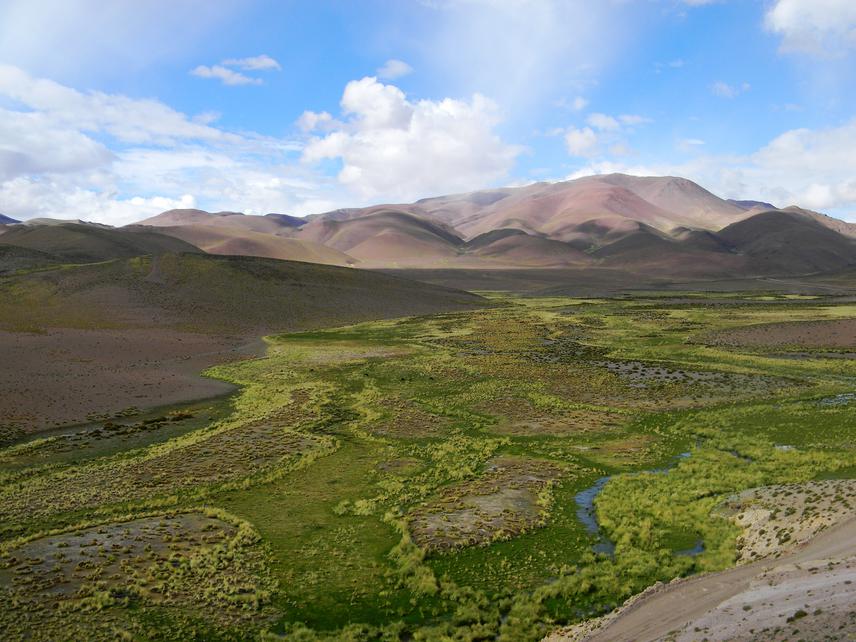
Incachule peatbog.
The High Andean wetlands are a key functional unit in Puna and Andean regions. They contribute a significant proportion of primary productivity, maintain vertebrate populations, and regulate hydrological resources, which have high incidence in urban and agricultural areas downstream. In addition, they are one type of ecosystem near the ecophysiological limits of terrestrial life. For example, recent discoveries of bacterial biodiversity and stromatolite communities are of vast scientific impact on theories about the origins of life.
While historically the region has been affected by grazing; presently climate change and mining prospects are the main threats of biodiversity and hydrological function. Previous studies of our work team showed a decrease of human and livestock pressure in the region, which resulted in an increase of wildlife (e.g. vicuñas). However, this relatively favourable situation for conservation with few conflicts with productive activities could be reversing. Future climate change scenarios identify high-elevation ecosystems among the most vulnerable, and the combination of global markets and domestic policies suggest mining will expand rapidly in the region, with potentially vast impacts on water cycles. Despite their ecological and economic importance, the geographic patterns of wetlands and dynamic of this system is barely known.
This project will develop spatial conservation planning strategies for subtropical Argentine High Andean wetlands based on the most pressing threats expected for the coming decades. Based on Marxan analysis of spatial information, we will define conservation targets based on geographic and functional features derived from satellite imagery. In combination with spatially explicit model of the main threats (climate change, mining prospects, grazing) and stakeholders’ workshop we shall develop consensual geographic guidelines for conservation planning.